Quarter Way Inn and Northward


So I started and ended my next two days of hiking at the Quarter Way Inn in Virginia. This place is amazing. Tina (thru hiker class 2009) is the a super host and staying in a house built in 1910 was so cool. They also have the most amazing breakfast you will ever eat and for some reason I forgot to take a picture of it but here are some pictures of the hostel and grounds.

DSCN1629

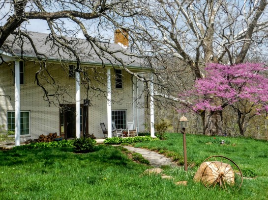
the house was built in 1910 the land grant goes back to 1799

DSCN1637

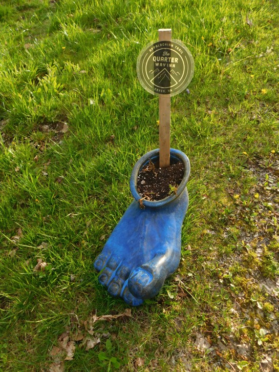
This planter cracked me up it looks like how hiker feet feel.

DSCN1635

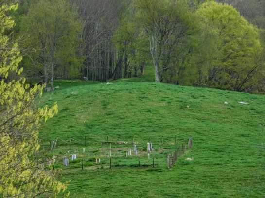
The cemetary across the road has graves dating back to 1802

DSCN1630

crepe myrtle in purple beneath the shadow of a huge sycamore hard to see in the pic but it is huge

DSCN1634

DSCN1632

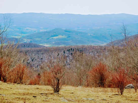
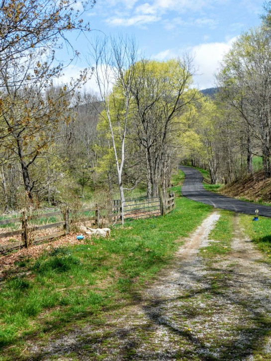
view from the back deck is amazing in the back ground the blue ridge is chestnut knob where the trail runs

DSCN1631

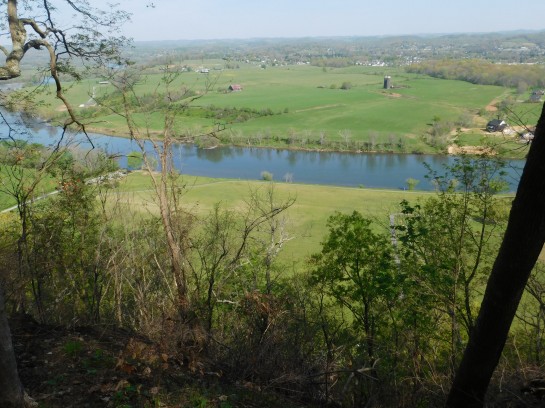
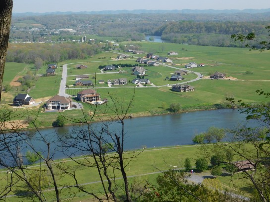
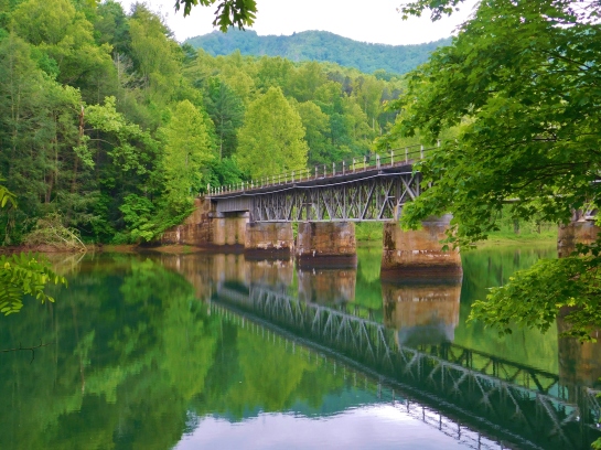
The hike out was one of the prettiest on the trail with views of farmland and rolling waves of mountains and a river crossing by an old mill.

DSCN1642

start of the trail up and over the fence style and up the hill

DSCN1641

trail across the meadow

DSCN1651

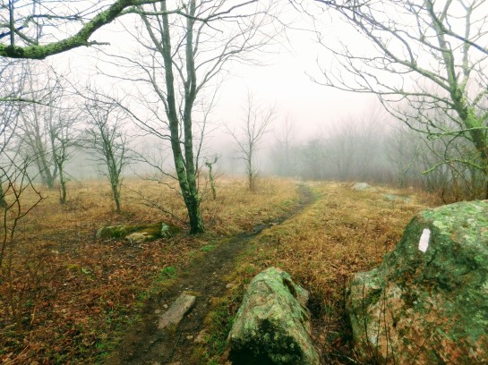
pretty and open views

DSCN1640

DSCN1644

trail marks across open ground 

DSCN1646DSCN1649

DSCN1648

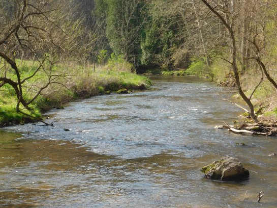
old mill north fork of the holston river in virginia
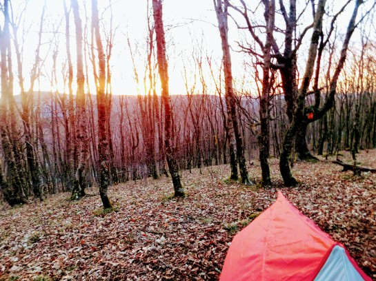
DSCN1654

DSCN1653

knot maul shelter

100+ miles of the Appalachian and Virginia Creeper Trails


So I started my Hiking season this year with plan to do a section of the Appalachian Trail and nearby connecting trails starting in Tennessee and heading up thru Virginia. Its been a wonderful experience so far I have enjoyed the beauty of the trail, hearing coyotes and screech owls, and seeing deer, and the wild ponies in Grayson Highlands State Park. I have enjoyed overcoming the physical and mental challenges of the trail and finding that I could accomplish and push myself far more than I ever thought. I have really been thrilled by how close knit the hiking community is and how we all look after and encourage each other and meeting people from all over the USA as well as Germany, France, England, Scotland, and Canada. Below are some photos from the first hundred miles. First is overlooking Watagua lake from the AT one of the prettiest views I had on the trail was sunrise from high above the lake. Fog completely covered the lake below but along the shore you could see the lights from the marinas along the shore it was a magical moment.

DSCN1529

Watagua lake seen from the AT

Next is Damascus Virginia and shots from along the Virginia Creeper Rails to Trails Hiking Path (the virginia creeper is a flowering vine but the trail takes its name from the railroad because it took so long for the train to creep over the mountains from North Carolina it was named the virginia creeper) The trail runs 34 miles from Abingdon to Mt Rogers Station in Virginia. I hiked mostly between Damascus and Mt Rogers Station. The trail is amazingly beautiful running alongside Laurel Creek and crossing it numerous times on the old railroad trestles. It is wooded at first then gives way to more open farmland and has some historic stations one is converted to a great cafe and the other at Green Cove Station is a museum.

DSCN1539DSCN1538DSCN1556DSCN1548DSCN1551DSCN1547DSCN1559DSCN1558DSCN1555DSCN1570DSCN1569DSCN1573DSCN1572DSCN1571


The next few scenes are from the hike up and over White Top Mountain which I did on a windy cold and foggy day it was surreal and an amazing experience camping at the top at over 5000 feet and waking to a clear sunrise after hearing the coyotes howling in the night:

DSCN1560DSCN1565DSCN1562DSCN1563

DSCN1564

Greeting the sun outside my wenzel tent

The next section covers from Grayson Highlands State Park to Atkins Virginia

DSCN1581

started out cold at Grayson Highlands State Park

DSCN1582

DSCN1583

view makes you feel as if you are hiking on the roof of the world or at least virginia

DSCN1588

thank you fellow hiker “sunrise” for taking this photo

DSCN1589

DSCN1590

wild ponies in the park

DSCN1591DSCN1595DSCN1596DSCN1567

DSCN1597

highest mt in the background is whitetop where i camped days before

DSCN1598

DSCN1600

comers creek falls virginia

had to get off trail for a few days to nurse an injured ankle following are pics from Laurel Run Park in Churchhill tennessee where i did a test hike to make sure am ready to get back on trail beautiful park with views waterfalls

DSCN1616DSCN1615DSCN1620DSCN1608DSCN1611DSCN1612DSCN1622DSCN1623DSCN1613


Waterfall & Walking Trails


DSCN0886

Above is the Watauga River behind Wilson Dam. It was a perfect spot and scene that just says peaceful. It was taken in May near Elizabethton TN in the Wilson and Watauga Dam Recreation Areas. Nice picnic and fishing areas where the Appalachian Trail crosses Wilbur Dam Road. There is a unique little waterfall as Little Laurel Creek (not to be confused with Laurel Run Falls that I wrote about last week) pours into the lake.

DSCN0879DSCN0880

The scenery is beautiful and makes for a great day to take a short drive through the area on a pretty road that follows the river

DSCN0887DSCN0901DSCN0903DSCN0889

If your in the mood for a longer hike you can hop on the AT and walk as long as you want just keep an eye out for bears in the area (the sign was put up after a bear went into a occupied tent the occupant was fine the bear was removed it had some sort of illness injury)

DSCN0896DSCN0892


Training for Appalachian Trail Hike


Here are a few photos from one my training hikes. Sorry I haven’t posted as much lately both because of the family needs I posted about earlier. Thanks to everyone for their prayers for my brother he is healing ahead of schedule and should be able to walk again in a couple of months and because drum roll I have begun training hikes to get in shape to do a thru hike of the Appalachian Trail. If you are not familiar with the trail it runs from Georgia to Maine 2180 miles. It takes most people 4-5 months to do. So hang with the blog and look for some great posts thru out this year and especially next year with posts from the trail. If any of you have hiked the trail or have experience with long distance back packing I would love to hear from you.